Work / Precision ag / Alfalfa
Drone scoutıng for a center-pıvot alfalfa operatıon
Multispectral flights over a family-owned alfalfa operation flagged a thirsty outer edge on one pivot, and the data pointed to a setting, not the nozzles.
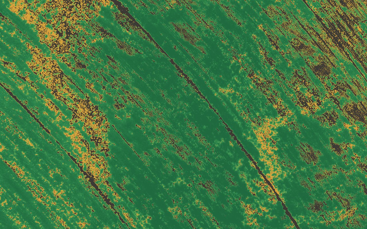
Client names appear only with permission.
The finding
The nozzles were fine. The speed setting wasn't.
On one pivot, the outer edge was consistently under-watered. The crew suspected the nozzles. The data showed the pivot speed was set too slow for the size of the field. A settings change, not an equipment purchase.
pivots flown over three days
setting to fix; the nozzles were fine
What we did
The problem
The crew could see thin spots on the outer edge but couldn't tell whether the cause was equipment or settings. Satellite imagery was too coarse to say.
The approach
- Multispectral flights with a DJI Mavic 3M on June 8, July 9 and July 10, 2026 covered 12 pivots.
- A pipeline built on NDRE, with masks for field edges and wheel tracks.
- A dashboard the farm's managers use to review each pivot.
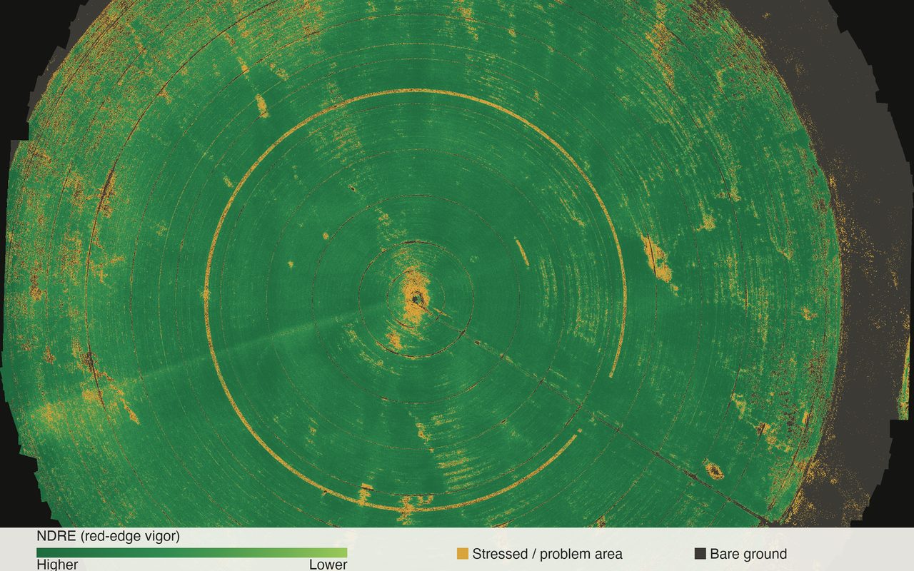
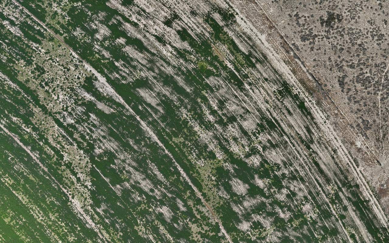
On the map
Same flight, two views.
The outer edge of the pivot as a color photo and as an NDRE map. The amber bands are the under-watered crop.
Key screens
What the team looked at.
Stack
- DJI Mavic 3M
- NDRE
- VARI
- Field dashboard
Start a project
Got a field worth a look?
Send a few lines about the crop, the fields and what you want to know. You'll get a reply from the pilot who flies it.